Professional Services
At Geospatial Engineering Services Ltd Ltd, we provide a wide range of professional surveying services using both traditional and state-of-the-art equipment. Whether you need a detailed site plan, elevation drawings, GPS control networks, or on-site Survey Control support — we offer cost-effective solutions tailored to your exact needs.
Measured Building Surveys
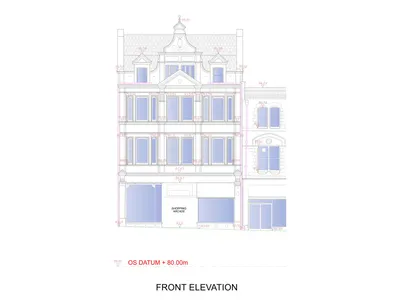
Accurate building surveys using laser scanning and traditional methods — delivered in CAD and PDF.
details Read MoreTopographical Land Surveys
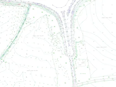
Accurate site mapping for planning, design, and construction — delivered in CAD and other formats.
details Read MoreUnderground Utilities Scanning
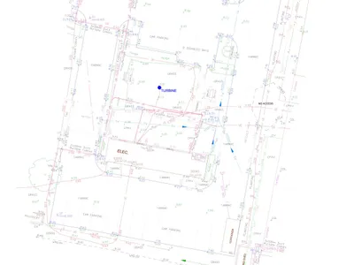
Accurate services detection for infrastructure, housing, and engineering projects of all sizes.
details Read MoreProjects Across the UK
From city centre developments to remote infrastructure projects, Geospatial Engineering Services Ltd Ltd has delivered precise and reliable survey data to clients nationwide. Our team is trusted by engineers, architects, planners, and developers to support everything from design and feasibility to construction and verification.